
$287.35K
1
1

1 market tracked

No data available
| Market | Platform | Price |
|---|---|---|
![]() | Poly | 41% |
Trader mode: Actionable analysis for identifying opportunities and edge
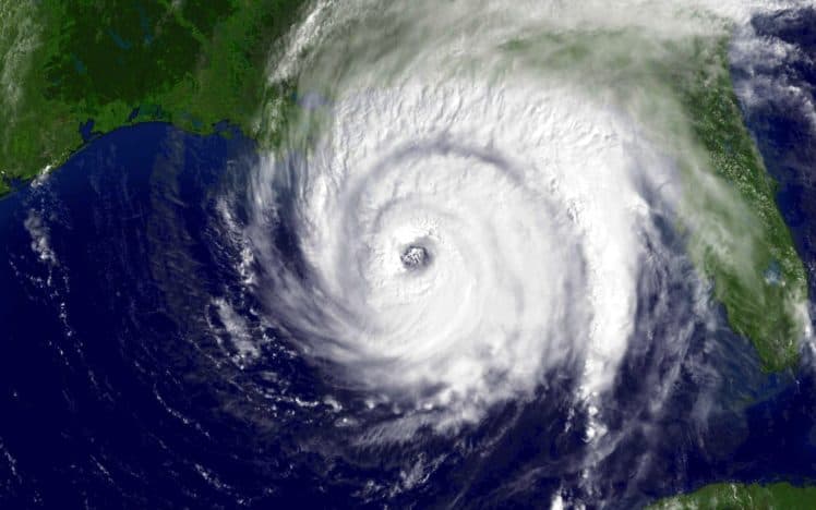
The 2026 Atlantic hurricane season will take place over a period lasting from June 1 to November 30. This market will resolve to "Yes" if NOAA names a storm in the Atlantic between December 4, 2025, and May 31, 2026. Otherwise, this market will resolve to "No". The resolution source for this market will be NOAA’s list of named storms during the Atlantic hurricane season (https://www.nhc.noaa.gov/data/tcr/) and/or their data on individual storms. If there is a potential named storm that has no
Prediction markets currently give about a 2 in 5 chance that a named storm will form in the Atlantic before the official hurricane season begins on June 1, 2026. With the probability at 41%, traders essentially see this as a coin flip. This reflects a significant amount of uncertainty about whether the typical off-season calm will be broken.
Two main factors are likely shaping these even odds. First, pre-season storms are not rare. Since 2015, a named storm has formed before June 1 in seven out of nine years. This recent pattern makes another early storm feel plausible. Second, forecasters are monitoring the potential transition from the current strong El Niño to a La Niña phase later in 2026. While La Niña tends to boost hurricane activity during the peak season, its influence on the May-June window is less direct. The current high ocean temperatures in the Atlantic, however, provide ample fuel for early development if other weather patterns align. Traders are balancing this history of recent early activity against the fact that formation before June is still the exception, not the rule.
The key period is the window from now through May 31, 2026. The most active time for pre-season storms is typically late May, as conditions begin to resemble the summer season. Official long-range seasonal forecasts from groups like Colorado State University and NOAA, usually issued in April, will be closely watched. These forecasts often discuss the risk of early activity. Any specific disturbance identified by the National Hurricane Center in the Atlantic basin during this period would cause the "Yes" probability to rise quickly.
Markets that bet on binary weather events like this one often aggregate expert and amateur analysis effectively. For hurricane-related questions, they tend to be reasonably well-calibrated because they incorporate real-time data like ocean heat and model forecasts. A major limitation is the inherent randomness of weather. A single storm forming in May depends on specific, unpredictable conditions coming together. The market's current 41% probability is not a scientific forecast, but it does represent a real-time snapshot of informed sentiment weighing the recent trend toward early seasons against historical averages.
Prediction markets currently assign a 41% probability that a named storm will form in the Atlantic basin before the official June 1 start of the 2026 hurricane season. With shares trading at 41¢ for "Yes" on Polymarket, this pricing indicates the event is seen as a distinct possibility but remains slightly less likely than not. The market has processed $287,000 in volume, showing significant trader interest in this specific meteorological bet.
The 41% probability reflects two primary climatological inputs. First, preseason storm formation is not rare. NOAA data shows that in about 60% of years from 2015 to 2024, at least one named storm formed before June 1. The market's sub-50% price, however, accounts for the specific forecast context for 2026. A key driver is the expected state of the El Niño-Southern Oscillation (ENSO). Current long-range models from agencies like the IRI suggest a potential transition from El Niño to neutral or La Niña conditions by next spring. La Niña tends to reduce vertical wind shear in the Atlantic, creating a more favorable environment for early tropical development. Traders are likely weighing this potential phase shift against historical frequency.
The odds will be most sensitive to real-time ocean and atmospheric data in the spring of 2026. A confirmed and faster-than-expected transition to La Niña conditions, signaled by NOAA's monthly ENSO outlook updates, would likely push the "Yes" probability above 50%. Conversely, a persistence of El Niño or neutral conditions would drive the price down. Specific short-term weather patterns in May, such as the early formation of a potent African easterly wave or a stalled frontal boundary in the Gulf of Mexico, could cause sharp price spikes. The market will react directly to any special tropical weather outlooks issued by the National Hurricane Center before June 1.
AI-generated analysis based on market data. Not financial advice.
$287.35K
1
1
This prediction market topic concerns whether a named storm will form in the Atlantic basin before the official start of the 2026 hurricane season. The Atlantic hurricane season is formally defined by the National Oceanic and Atmospheric Administration (NOAA) as running from June 1 to November 30 each year. This market specifically resolves to 'Yes' if NOAA officially names a tropical or subtropical storm in the Atlantic between December 4, 2025, and May 31, 2026. The resolution will be based on NOAA's official storm archives and advisories. The question taps into meteorological patterns and climate trends that can produce organized tropical systems outside the traditional season. Interest in pre-season storm activity has grown in recent years as several notable storms have formed in May or even earlier, challenging the conventional seasonal boundaries. Meteorologists, insurance companies, emergency managers, and coastal residents monitor these early developments closely, as they can signal an active season ahead and require early preparedness efforts. The market allows participants to weigh scientific forecasts against historical probability.
The official Atlantic hurricane season dates were established by NOAA to encompass the period when the vast majority of tropical cyclone activity occurs. However, named storms forming outside this window are not rare. Since reliable records began in the satellite era (around 1966), there have been numerous pre-season storms. A significant precedent was Tropical Storm Ana in May 2015, which formed near the Bahamas. More recently, Tropical Storm Arthur formed on May 16, 2020, marking the sixth consecutive year with a named storm before June 1. The earliest forming named storm in the satellite era was Tropical Storm Arlene, which was named on April 20, 2017. Before the satellite era, historical records suggest a storm formed in January 1938. The frequency of these early storms appears to have increased in recent decades. This trend is a subject of scientific study, with some research linking it to warmer ocean temperatures that provide the energy for tropical systems to form earlier in the year.
The formation of a named storm before the season officially begins has practical implications for public safety and the economy. For residents in coastal regions from Texas to New England and across the Caribbean, an early storm can catch communities unprepared. Many seasonal preparedness activities, such as stocking emergency supplies and reviewing evacuation plans, are timed for the June 1 start date. An early storm can therefore lead to greater risk and potential loss of life. Economically, early storms can disrupt agriculture, offshore energy production, and shipping. They also trigger insurance claims, affecting the reinsurance market and potentially leading to higher premiums. For scientists, early activity is a data point in understanding how climate variability and change are affecting tropical cyclone behavior. A pattern of more frequent pre-season storms could lead to calls for an official reconsideration of the seasonal timeframe used by emergency management agencies.
As of late 2024, the focus for the 2026 season is on long-range climate indicators. Forecasters are monitoring the state of the El Niño-Southern Oscillation (ENSO). A transition from El Niño to neutral or La Niña conditions by the spring of 2026 is considered a potential factor that could favor early season development. Sea surface temperatures across the Atlantic basin remain at record or near-record highs, a trend that has persisted for over a year. If these warm anomalies continue into the spring of 2026, they would provide more fuel for any early-season disturbances. The official first seasonal outlooks for 2026 from Colorado State University and other groups will not be issued until April 2026, but preliminary discussions among meteorologists already note the potential for an early start given the ongoing warm ocean phase.
A tropical storm has a warm core and gets its energy from warm ocean waters. A subtropical storm has characteristics of both tropical and non-tropical systems, with a broader wind field. For the purposes of this market and NOAA's naming conventions, both types receive a name and count equally toward resolution.
Yes. While less common than named storms, hurricanes have formed in May. For example, Hurricane Alma in May 1970 and Hurricane Alex in January 2016, though Alex was a very rare winter hurricane. The market resolves on any named storm, which includes tropical storms and hurricanes.
The World Meteorological Organization maintains six rotating lists of names for Atlantic tropical storms. These lists are reused every six years, though names of particularly destructive storms are retired. The 2026 list will be a reuse of the 2020 list, starting with Alex.
This date is likely chosen to provide a clean break after the official end of the 2025 hurricane season (November 30) and a brief buffer period. It ensures the market exclusively covers the off-season period before the 2026 season, avoiding any ambiguity from late-season 2025 storms.
Yes. The resolution window runs from December 4, 2025, through May 31, 2026. A named storm forming in December 2025, January, February, March, April, or May 2026 would all result in a 'Yes' resolution. Winter storms are rare but possible, as seen with Tropical Storm Zeta in December 2005 and Hurricane Alex in January 2016.
Educational content is AI-generated and sourced from Wikipedia. It should not be considered financial advice.

No related news found
Add this market to your website
<iframe src="https://predictpedia.com/embed/ML6Ybs" width="400" height="160" frameborder="0" style="border-radius: 8px; max-width: 100%;" title="Named storm forms before hurricane season?"></iframe>